Friday, June 30, 2006

The Other Towers

With all the attention being paid to the water towers that Eddie Diana and KJ want to put in Gonzaga Park, there is another park being overlooked.

Few people seem to have noticed that two new towers have been erected in nearby Gazonga Park.


Friday, June 23, 2006

The Water Towers That Wouldn't Die

Swiller emailed a request that the Uncle post this, so:

Fridday, June 23
Michael Amo appears to have gotten the Gonzaga water towers onto the County Legislature's Rule's Committee agenda (despite Spencer McLaughlin's resistance).

Amo and Szegedin want KJ's water towers in the County park rather than taking up space (and dollars) in KJ itself.

The hearing is at 3 pm today (Friday) on the third floor of the County Building.

The more bodies present, the better.

If anyone can make it - please go.

Thursday, June 22, 2006

One For Two

Two decisions came down the pike today.

One made the Uncle happy.

One made Caruso happy.

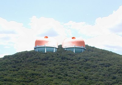
The County Legislature's Physical Services Committee considered Eddie Diana's request that the Legislature take steps aimed at putting two KJ water towers into Gonzaga County Park. The committee voted not to send the request to the floor - killing it (for now).


As Eddie saw that his gambit wasn't going to succeed he backpeddled faster than Wylie Coyote noticing that he's 5 feet beyond the cliff edge. (Wow is that a labored analogy?)


"I just sent the request here for a yes or no vote," said our County Supervisor. "I don't care if you vote yes or no."


Committee requests for certain studies were not answered. Eddie explained that he was dilligently guarding the County treasury and that he wouldn't spend money on studies for a project that might not go forward.


Or, as Spencer McLaughlin summed it up: "Questions, asked in order to reach a yes or no decision will not be answered until we reach a yes or no decision."


Roxanne Donnery asked: "Is this what we want to do with our parkland?" And Michael Amo answered yes. He explained that if KJ built the water towers that would serve KJ in KJ it would be an ugly blight (right in the middle of beautiful downtown KJ) and so it was solely to preserve the natural splendor that is KJ that KJ wanted to hide them from view in a county park."


Ya gotta love the guy for trying!


As for Caruso's win -- at the moment it seems that Elaine Slobod, generally one of the best judges in Orange County, may have bought a line of bull from Caruso's lawyer on the Woodbury vote that would allow the Brodsky project to go forward.


We're still waiting for more info, but Slobod may have bought the argument that the County Planner is supposed to get 30 days after Brodsky's Final Environmental Impact Statement (FEIS) to comment on Woodbury's proposed local laws.


In fact, under state law the planner gets 30 days after he is notified of the pending laws.


What Brodsky's FEIS has to do with the timetable is unknown.


But, if this setback convinces Brodsky to throw up his hands and sell the land to the highest bidder, than KJ's Vaad haKirya gets to scoop up a huge parcel that sits right next to ACE Farms. This is apparently what Caruso (and Larkin and Donnelly and Siebold and Ungerer and Seyferth et al) have been pushing for.


If Brodsky hangs on, Slobod's decision will be overturned. But how long will that take?

Friday, June 09, 2006

Clustering, Get it?

Anonymous said... C'mon U.B. let's keep the debate honest. The WP3 property was down zoned to 1 acre so that coupled with the clustering it would yield 1/4 acre zoning.
Just to clear up any misconceptions
.

Okiedoke. Let's clear up the misconceptions. That way we can make room for you to bring in new ones.

First, with the exception of the senior housing in WP3, there will not be any 1/4 acre lots. None!

WP3's homes will be on lots larger than Don's 1/2 acre homestead, many at about 1 acre. Legacy Ridge, which has no special senior housing will be on larger lots than WP3.

But the central point that you miss is that clustering is the goal. Putting houses on 1 acre lots instead of 2 acre lots, allows the creation of large areas of undeveloped land around the homes. That's a good thing.

So, here is a somewhat lengthy (sorry) excerpt from The Planning Commissioners Journal. Have someone read it to you and maybe you'll finally get it.

Conventional zoning is essentially a blueprint for development, and development alone. Of course, zoning normally separates incompatible uses, and it does establish certain standards (such as maximum densities and minimum setbacks), but it typically does little to protect open space or to conserve rural character. The reason many subdivisions consist of nothing more than houselots and streets is because zoning and subdivision design standards usually require developers to provide nothing more. While many ordinances contain detailed standards for pavement thickness and culvert diameters, very few set any noteworthy standards for the quantity, quality and configuration of open space to be preserved.
Conventional zoning assigns a development designation to every acre of land, generally residential, commercial, or industrial. The only lands which are normally not designated for development are wetlands and floodplains. Conventional zoning has been accurately described as "planned sprawl," because every square foot of each development parcel is converted to front yards, back yards, streets, sidewalks, or driveways. Period. Nothing is left over to become open space, in this land-consumptive process.


[Editor's Note: The Center for Rural Massachusett's Web site contains excellent drawings comparing development under conventional zoning principles and development using open space/cluster principles].


A Better Solution
Local officials who are interested in ensuring that their communities will not ultimately become a seamless web of subdivisions, shopping centers and office or industrial parks now have a practical and effective alternative: compulsory open space zoning. This technique has been successfully implemented by a number of municipalities in New England and the Mid-Atlantic states, and by several counties in Virginia, Washington State and California.

In order to avoid disturbing the equity held by existing landowners, open space zoning allows the same overall amount of development that is already permitted. The key difference is that this technique requires new construction to be located on only a portion -- typically half -- of the parcel. The remaining open space is permanently protected under a conservation easement co-signed by a local conservation commission or land trust, and recorded in the registry of deeds.

As "open space zoning" is based upon the technique of "clustering," these two terms are used interchangeably throughout the rest of this article. It should also be noted that the cluster concept can be restricted to detached, single-family homes, each on its own down-sized houselot, in communities or in specific zoning districts where this is politically desirable. In other words, cluster housing is by no means limited to townhouses, apartments, or condominiums, as is typical in many PUDs (planned unit developments) and PRDs (planned residential developments). In fact, the classic rural village settlement pattern is a superb example of single-family clustering, sometimes with a central green constituting the permanently preserved open space.

Cluster Design
The basic principle of cluster development is to group new homes onto part of the development parcel, so that the remainder can be preserved as unbuilt open space. The degree to which this accomplishes a significant saving of land, while providing an attractive and comfortable living environment, depends largely on the quality of the zoning regulations and the expertise of the development designer (preferably someone experienced in landscape architecture).

Although the concept of clustering is fairly simple, this "new" form of development has raised concerns among some residents of rural or suburbanizing areas because it is quite different from the conventional, standardized subdivision pattern with which most of us are very familiar. Interestingly, the conventional suburban model, commonplace in many growing communities, is actually a pattern that is at odds with the otherwise traditional rural landscape. It looks "at home" only in our sprawling metropolitan post-war suburbs, where it has become the predominant building pattern.


for the rest go to: http://www.plannersweb.com/articles/are015.html

Wednesday, June 07, 2006

Siebold Clears Up Misconceptions (Also Pigs Fly)

Photo News
Friday, June 02, 2006

To the editor:

The notice that appeared in the May 19th edition of The Photo News under “Out & About” listed a tag sale as CThis was incorrectly titled.We are just citizens working together to raise funds to support a law suit brought against the Town of Woodbury in reaction to zoning changes approved by the Town Board that created high density housing zoning.The tag sale was correctly titled in the May 20th edition of the Times Herald-Record’s garage sale section as “Highland Mills Tag Sale/Fundraiser - Everything Goes.”I hope this clarifies any misconceptions.
Thank you.
Donald Siebold
Highland Mills

Gee Donnie, where did that name, Woodbury Action Committee (or WAC), come from? Did the Photo News make it up? Or did you WAC jobs realize that you would have to file info on the committee and decide that that required a little more information coming to light than you folks were comfortable with?

Also, the flyers that you put all over Woodbury seemed to leave out that the tag sale was a fund-raiser for the law suit against the town. Just an oversight, I'm sure.

Finally, how many times are you going to trot out the "high density" bullshit? How come you never say that the projects you are suing over have 1 acre and 2 acre zoning?

Try tackling those misconceptions you lying sack of (ahem)...you silly fellow.